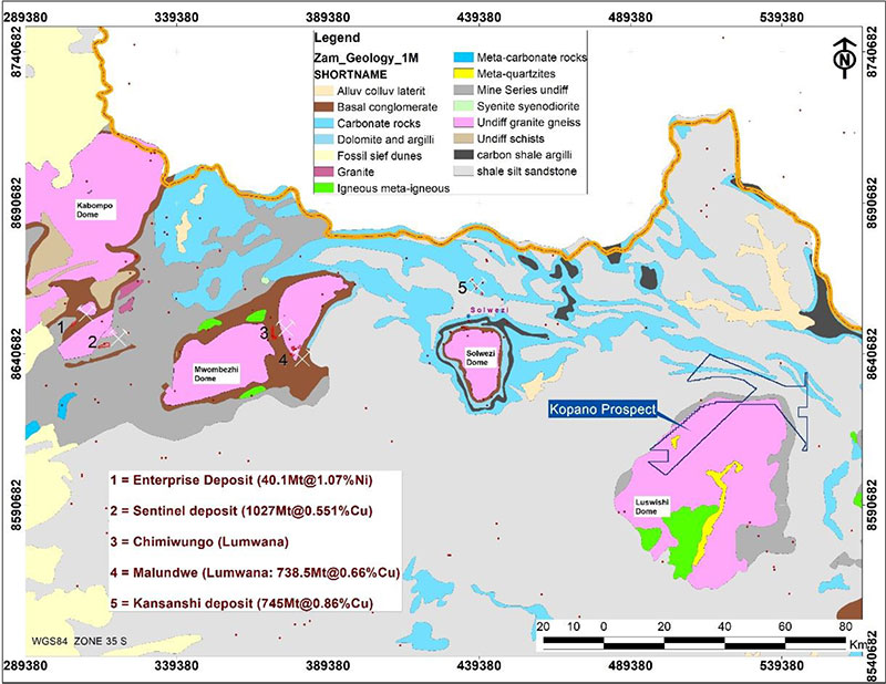
Largely situated in the Lufwanyama District (Copperbelt Province) with minor parts of area in Chingola and Solwezi, the Luswishi North Project covers 553 km2 of exploration ground on the northern and northwestern flanks of the Paleoproterozoic Luswishi Dome.
Beltz believes the Luswishi North Project represents significant prospectivity for stratiform sediment-hosted and vein-style Cu-Au-U-Co mineralisation, given its location in the eastern lobe of the 800km-long Lufilian Arc, known for world-class copper deposits including Kansanshi, Lumwana and Sentinel.
The Luswishi Dome has an inner core of granite-gneiss rimmed on the outside by Neoproterozoic metasedimentary rocks (Katangan Supergroup). This portion of the dome has been subjected to continuous exploration since the early 1950s when auger drilling revealed presence of anomalous copper in near-surface soils exceeding 1% over strike length of nearly 2 km. Follow up diamond drilling programmes confirmed presence of copper ore in the Roan Group where it occurs as chalcopyrite in calcite veins, similar to how it occurs at First Quantum Minerals’ Kansanshi deposit (745Mt@0.86%Cu, with Au credits) situated 81 kilometers to the west.
- At Kansanshi copper-gold deposit, mineralisation occurs in 3 dominant styles as follows;
- Steeply dipping, sheeted quartz-carbonate-sulphide veins,
- Sediment-hosted, mineralised haloes to the veins, and
- Sulphide crackle and stockwork breccias in zones of higher veining density.
The veins range in thickness from a few millimeters to about 6 m and are predominantly vertical to subvertical trending in diverse directions but in general they follow the NW-SE trending zone. Individual veins mostly have N-S trends and strike lengths vary from hundreds of metres to about 1.2 km with widths of roughly 200 m and vertical dimensions not exceeding 300 m deep.
Similarly, copper mineralisation at Kopano’s Luswishi project occurs dominantly as chalcopyrite in calcite veins which have thicknesses varying from 10 cm to about 10 m with grades ranging from 0.94% copper to 11.71% occurring at depths of between 80 – 600 m in Upper Roan dolomites.
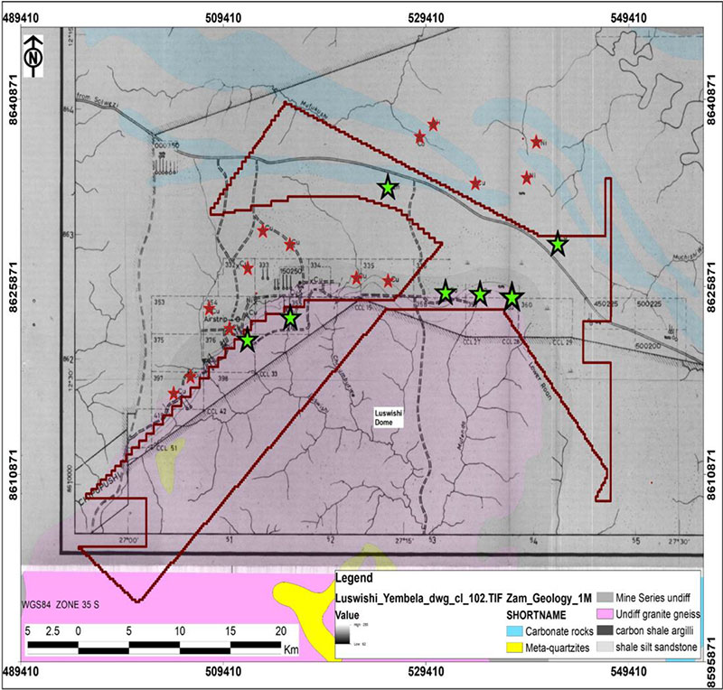
Overall, the Luswishi project has good exploration data generated by past explorers that is available for review to aid new exploration. These data sets include:
- Good gridded geochemical data
- Falcon/BHP/FQM/Vale and Anglo Spectrem geophysical data
- Airborne magnetics and radiometrics data at 400m spacing
- Historical drillholes stored at the chamber of mines/ZCCM-IH core yard in Kalulushi ∙ Recent drillholes completed by Vale (stored in Kalulushi/Geological survey)
